Lucy's Revenge is a project in memory of Lucy Plunkett to raise funds for Alzheimer's research and support services while showcasing Mississippi's waterways. All donations go directly to the Mississippi Chapter of the Alzheimer's Association.

Announcements

The Longest Day is June 20! We'll be putting in 50 miles in one day on the Pearl River.
Showing posts with label Trip Log. Show all posts

Monday, March 21, 2011

Ross Barnett Reservoir and surrounding waters ripe for the picking.

BY: B. Keith Plunkett


If there is ever an easy answer to the often posed question about where to have an worry-free paddle without the worry of shuttling in Central Mississippi, it has to be the Ross Barnett Reservoir. This week Lucy's Revenge, in conjunction with the newly formed Central Mississippi Paddling Mafia, took to the Ross Barnett with a vengeance in an attempt to see what she had to offer. The idea was to find a way to hit the water quickly and put in a few miles after work, or on a quick whim.

We had no problem.

On Tuesday afternoon Kelly McGinnis, Dawn Henderson, Sharon and I launched from Pelahatchie Shore Park for a sunset tour of Pelahatchie Bay. It was beautful enough that my video from the 4 mile trip inspired another paddling friend, David Ogletree to hit the water this past Sunday to see if he could spot a few of the many hundreds of white pelicans we surprised on the north side of the bay.


The full moon rises over the Pearl River on Friday, March 18.
 Friday night brought a full moon, and an opportune time for an 8 mile paddle from Ratliff Ferry to Tommy's Trading Post at Goshen Springs. Kelly, Sharon and I were joined by Michelle Blair and Daniel Stuart. We watched a beautiful sunset and moonrise and paddled past a few campsites as people readied for what turned out to be a sensational weekend of weather. We made it in 2 hours and 20 minutes.

Saturday morning I awoke determined not to get caught at the house. So, I and my youngest son Rickey headed out for an overnight trip down the Pearl River from the spillway to Lefluer's Bluff; a 12 mile trip. With the help of my trusty shuttling assistant and oldest son Isaac, I dropped my equipment and Rickey at the spillway, drove my vehicle to Lefluer's Bluff and was driven back to start our adventure.

Rickey Plunkett on the Pearl River.
The launch at the spillway was crowded with fisherman, but just beyond the first river bend the noise of the spillway and the mass of humanity surrounding it was already a memory. The water was pushing at a brisk 4 miles per hour, and we easily floated a quick 4 miles before deciding on a sandbar to make camp.

Rickey spent hours that afternoon sitting in the sand next to the river, digging holes, reading, and just being a kid. There's not a video game in the world that can compete with that. There's nothing quite like seeing your kids lose themselves in the slow pace of the outdoors. That evening, we watched another awe inspiring moon rise over the trees, and after hours of rare uninterupted conversation by the campfire we were serenaded to sleep by a chorus of owls singing along to the background sounds of water churning past fallen limbs.

A beautiful sunrise the next morning and a couple of hot chocolates, and we were packed and back on the water. An almost 8 mile trip should have taken us a couple of hours, but the Pearl River was pushing us along fast, and we were landing at Lefluer's Bluff in just over an hour. I'm glad I got the opportunity to take Rickey with me on this trip, but I'm accustomed to putting in over 40 miles in a weekend. I still wasn't satisfied and I wanted more.

The paddling gods were smiling. By the time Rickey and I stopped off for a quick bite at my friend Roberto's restaurant, my phone was buzzing with another opportunity. Kelly was sending out a call to all members of "the family" to meet up at Pelahatchie Shore Park for an afternoon of exploration. My reply to his text was a simple, "I'm in."

Rickey stayed at home to shower and rest up in preparation for a new week at school. I headed south out of Flora towards Ross Barnett, yet again. Entering Pelahatchie Shore Park, I found a mass of people walking, fishing, disc golfing, and some just laying out on the grass looking up at the cottony clouds. There were no signs of my crew, so I found a parking place to wait. That's when David Ogletree drove up and got my attention and we began talking about where I had spotted the white pelicans a couple of days before. A few minutes later my crew began to arrive; first David Christopher then, Michelle and her husband Kelvin, finally Kelly and his daughter and a friend.

We stayed away from the boat launch. It was a site of constant action and turmoil from boaters loading an unloading their fishing rigs. Instead we launched from a small inlet with easy access. Paddling around the tip of the peninsula and avoiding the boats, we headed east. The water began to lose it's chop as we found ourselves among a couple of small islands and interior waterways. We crossed underneath Spillway Road and into a wooded area adjacent to Millcreek Subdivision, finally running into an impassable weir about two and a half miles into the trip. Were the water not being released at such a clip from the spillway due to heavy rains, we likely could have paddled another mile. Forced to turn back, we made our way through the wooded area again. The west side of the little tributary provided a little visual entertainment: 10-12 foot tall red blooming azalea's, old forgotten camellia's still showing some blooms from their winter show, and the show of light purple wisteria climbing over and through the woods as if in search of something.

We talked of future paddles; our newly formed band of boating brethren.

The summer days are thankfully long, and opportunities are everywhere on and around "The Rez".

Thursday, March 17, 2011

Pelahatchie Paddle Around (Video)

Sharon and I enjoyed a sunset paddle around on Pelahatchie Bay at the Ross Barnett Reservoir Tuesday with Dawn Henderson and Kelly McGinnis. We stirred up a few white pelicans, and netted an additional 4 miles.


Wednesday, January 19, 2011

Trip Log: Lost and Found on Pelahatchie Creek

BY B. Keith Plunkett

A friend and coworker has spent the last year and a half listening to me tell tales of paddling all over Mississippi. He finally had enough of it and purchased himself and his wife a couple of Wilderness Pamlico 120’s in December. We scheduled a rendezvous at Pelahatchie Creek. The creek enters Pelahatchie Bay from Rankin County to the East, which in turn feeds into the Ross Barnett Reservoir.

It was a close central meeting point for us, he coming from Brandon, and I from Flora. I had yet to paddle Pelahatchie and had been hearing good things about it being a great afternoon in and out spot. He was anxious to get his new boats wet.

Weather forecasts had been warning for almost a week of an impending ice and snow storm that would shut down everything. Anxious to get in some time on the water prior to the doom of the Snowpocalypse, Sharon and I bundled up and prepared for a cold January paddle. His wife joined us, too.

Launching from Pelahatchie Trading Post we paddled 3.5 miles before the setting sun forced us to turn back.

We launched from the boat ramp behind the Pelahatchie Trading Post at around 2:00 that afternoon. The GPS showed the trip to be one longer than we could complete in the short daylight hours we had left. So, we decided to make it a leisurely trip, get as far as we would, and then turnaround and come back.

Paddling East under Highway 471 we passed by a few fisherman hunkering down in the well protected areas at the mouth of the Creek. The wind in open areas wasn’t terrible, especially with the sunshine, but the fishermen we spotted appeared less concerned with a catch than with just being there. For the first three or four bends we rounded in the creek we spotted fishermen, all said they had caught nothing.

Golfers were out playing the adjacent course of Bay Pointe that abuts the creek for about a half mile. Mississippi’s winter 2010-2011 has been tougher than in most years. This day was hardly good for golfing, but folks accustomed to being outside can only take so long before cabin fever begins to set in. There was no look of seriousness to any of the play, but you could tell people were happy to have a day of sunshine.

It is easy to see this is a favorite paddle spot for day-trippers. Downed trees that could have likely caused problems were eaten away in spots from some previous visitor’s chainsaws. The creek is loaded with logjams, but they are obviously cleared with great regularity. And, it’s a good thing. There are no sandbars, at least in the short 3 and a half mile run upstream we did. So had we run into an impassable jam, the choice in most places was to turn around and call it a day.

At around the 3-quarter mile mark the open golf course to our right disappeared and we were swallowed up by the surrounding trees. As we meandered upstream, I prepared for a quick couple of shots with the camera. I allowed the others in my party to paddle ahead, as I still have a hard time talking to a camera with others around me. A few shots here and a few there and I began paddling to catch up with my crew.

The only opening I would see again in the heavily forested creek would be immediately surrounding Highway 25. But as quickly as I descended from the woods, once crossing underneath the bridge there and I was just as quickly back into the thick of it.

At this point, I should have caught up with the other three paddlers. But, I had not. I thought to myself that maybe during my few months of not paddling as frequently I was not in as good shape, but surely I hadn’t lost that much. Even though I’ve been in a couple of kayak races, I’m a touring kayaker, not a true racer. Still I could easily sustain speeds in excess of 5 miles per hour and, unless my GPS was really bad off, I had hit 6 miles per hour on a few bursts. How could they have gotten that far away so quickly?

I rounded bend after bend, nobody. Just me, the woods, the water and an increasing number of deer and squirrels.

As I was trying to decide whether they had turned off the main route, or whether I was just crazy. I began to see wildlife, lots of it. How could I be spotting deer and squirrel that undisturbed had my cohorts already been through here? How could they have turned off so easily? The creek is fairly easy to track.

At that moment, a big splash jolted me out of my deep thought. River Otters! I had seen them before on the Chickasawhay, but these guys were close, two of them. They were much more playful and curious too. I scrambled for my camera once again forgetting about my paddling companions.


After playing with the Otters, my thoughts began to focus again on finding my wife and friends. It seemed obvious that they must have made a wrong turn. I had noticed several cuts that crisscrossed the creek. But they weren’t big enough to mistake for the main creek. Were they?


I sat silent.

I paddled ahead a short distance.

I paddled back a short distance.

I began to worry.

My wife is going to being ticked off!


And then, there they were. The signs had all been there. The animal’s I was seeing was an indication they hadn’t been this way, and they hadn’t. They had made a wrong turn. Sure, it was easy for me to keep on the creek, I had the GPS. And they, well they didn’t. I took my wife’s not so subtle irritation like a man.

Yes dear.


I do get lost in my thoughts out here. But, that’s part of the allure.

We paddled a little farther upstream, before turning back. We loaded the kayaks just as the sun and the temps were dropping fast. We’ll be back to do the whole thing, and next time I’ll try to keep up with my crew.

Monday, November 22, 2010

Tenn-Tom around Columbus offers opportunity for paddlers with a bent for exploration.

BY: B. Keith Plunkett

November 22, 2010--The Tennessee–Tombigbee Waterway is a 234-mile artificial waterway that provides a connecting link between the Tennessee and Tombigbee rivers. The waterway begins at Pickwick Lake on the Tennessee River, then flows southward through northeast Mississippi and west Alabama, finally connecting with the established Warrior-Tombigbee navigation system at Demopolis, Alabama.

After 12 years of construction, the waterway and its seventeen public ports and terminals opened to commercial traffic in January 1985. In addition to the original 110,000 acres of land acquired for the construction and operation of the project, another 88,000 acres have been purchased and managed by the two state conservation agencies for wildlife habitat preservation and mixed use including hunting and parks.

Sharon and I, along with fellow paddler Dawn Henderson, used one of these parks, DeWayne Hayes Recreation Area, as our base of operation to explore the waters north of Columbus Lake. DeWayne Hayes is operated by the Army Corps of Engineers and is very well maintained and heavily used, especially when there is a big SEC game happening just up the road in Starkville. Despite the numbers we were able to claim a very quiet location in the primitive camping area.


Monk waits patiently for his opportunity to play
in the Tenn-Tom Waterway.
 We set up camp Saturday afternoon and, as luck would have it, our site was immediately adjacent to a two-foot shelf where Stinson Creek met the Tenn-Tom and was protected by a small group of cypress stumps. We were easily able to get in and out of our kayaks without worry about falling out into deep water. This private access area also gave me an opportunity to play around in the water with my sidekick Monk. Monk is my seven-year old yellow lab. I miss not having him with me on kayak-camping paddling trips. But there isn't enough room in my 14-foot Wilderness Tsunami. These trips that allow me to set up a base camp means Monk gets to come along.

Stinson Creek enters the Tenn-Tom just north of the park. The creek and the waterway are defined by the wide open areas between the tree-lined banks, but the flooded swamps in between offer some interesting sites to explore, as does the Cypress Swamp to the south of the camp that flows under and around Highway 50. We took a sunset paddle north on Stinson, paddling in and out of several swamps before hitting the big creek, turning on to the Tenn-Tom and heading south.


Dawn took this picture at the end of the first excursion.
The picture is looking back up Stinson Creek as the full moon
was rising in the distance.


 An evening of vittles made possible by my ever-increasing campfire cooking capabilities left us all rubbing our bellies and yawning. The encore came the next morning as I pounded out another stellar meal (if I must say so myself) accompanied by campfire coffee. Funny how it always taste better around a campfire, huh?

We then hopped in the kayaks and headed south towards the entrance to Cypress Swamp. As clearly indicated by the map of our route, we explored a great deal. The water was suprisingly clear, and the water hyacinths and grasses taking root on top of them were extremely thick in some areas.

There is something both comforting and haunting about paddling around in a swamp. Maybe because, due to the stumps and floating plants, it's impossible to get into a hurry. You have no choice but to take your time. But, there is something hauntingly familiar about it, too. With the exception of the occasional distant sounds of vehicles crossing the Highway 50 bridge in the distance, there was an eery quiet. Every so often, a suprised Blue Heron would startle ahead of me and begin a clumsy attempt at takeoff, all legs and neck and squawk. But, other than the sometimes yapping of the prehistoric looking birds, it was just the sounds of the paddles and the water.

We headed out of Cypress Swamp heading south on the Tenn-Tom for about a half mile. I noticed several other inlets on the west side of the waterway worthy of exploration. But, by this time the clock was telling me not to forget I had an appointment this evening back in Madison. I did my best to get the heart pumping on the paddle back, running off and leaving my companions to themselves. I was hoping to get in the excercise I would miss out on by not paddling the 25 to 30 mile days my body has become accustomed to. I may not have added as many miles in the 10-mile trek as I normally do, but I certainly got something out of the trip.

I hope to one day paddle the entire length of the Tenn-Tom. It's worthy of a longer closer look.


Above is the route from campsite north up Stinson Creek and around the point heading back south on the Tenn-Tom. The next day we headed south and, as you can see by the loops in the route around Highway 50, we explored the swamp as extensively as time allowed.

Wednesday, September 22, 2010

Thanks to Ashlee Clapper, Lynn Boykin and Girl Scout Troop 5375 for the Strong River of Memories.

I am incredibly behind on posting Trip Logs, and editing photos and video. I have recently downloaded some software for video editing. Provided I can figure that product out, I will have something more than the raw footage of some of the trips to post. At the very least I should be able to get some slideshows up soon. With respect to my Trip Logs; I have a few, but even the ones that are complete could use another edit.

Yes. I am behind schedule--story of my life!

Keith Plunkett and Ashlee Clapper
But, I had to take a time out here to say a big thanks to Lynn Boykin and her Girl Scout Troop 5375 for helping out with the project. Ashlee Clapper (I kept calling her Ashlee Cooper, Sorry Ashlee) is one of her girls who needed to put together a project for her Silver Award. I am extremely grateful that she picked Lucy's Revenge as her outside project. Ashlee managed to get the largest number of paddlers we have ever had for a paddle for her project called Strong River of Memories. Also participating were parents, siblings, and both the Development Director and Executive Director of the Mississippi Chapter of the Alzheimer's Association.


Now that's a good looking group of paddlers!


It was a beautiful day, a beautiful river and a beautiful group.

More to come. . . eventually.

Thanks,
Keith.

Thursday, September 16, 2010

Sometimes what makes these trips so special are the little things.

Critters big and small are everywhere on the Chickasawhay River:


An abundance of minnows offer the mullet and other species of fish plenty to feed on in the Chickasawhay:


A school of mullet swimming upriver in the Chickasawhay at around Mile 12. The mullet are extremely aggressive in the East Mississippi river:

Tuesday, July 27, 2010

Trip Log: July 21, 2010--Pearl River, Ratliff Ferry to Highway 43--Some Things Just Happen (Video Included)

Sometimes things just happen, and you CAN explain why: it’s because they’re intended to. Agnostics and atheists try their best to explain away these circumstances. But, they can’t. Those of us with Faith know when divine intervention happens. Those without faith simply aren’t prepared to recognize divine circumstances, or they are too married to their perception of life as primordial suffering and explain it away as chance. But, life sure is good here on the other side. Over here, every happening offers an opportunity for a response that puts all of us in line with God’s intention. When these marvelous interventions are life affirming, all feels right with the world.

Such was the case for me on Wednesday, July 21.

Sharon and I decided last Tuesday we were going to find a body of water somewhere for a mid-week paddle. We weren’t sure exactly where. We have been discussing a mid-week paddle for a while in order to take advantage of the long summer days. So, despite the unknowns, we loaded the kayaks Wednesday morning. This was the first time we loaded the boats on a whim without specific plans. Sharon took off to her office, and I mine.

At lunch she ran into a paddling friend of ours who, when seeing the boats on top of the vehicle, said, “Oh, you and Keith must be going to meet Scot at Ratliff Ferry this afternoon.”

My wife’s response was simple enough, “Who?”

You see until Wednesday afternoon, we had never heard of, yet alone spoken with, Scot Thigpen. But because of divine providence, within two hours he, Sharon and I, along with six of Scot’s paddling partners, lovingly referred to by Scot as the “River Rats,” were on our way for a sunset cruise on the Pearl River. Had the circumstances stopped there it would have been fortuitous enough, but there was more for me to learn.

It turns out that Scot wrote a book called Chasing Solomon. It is a book about his faith, a book inspired by his grandmother’s exemplary life which steered him towards a path of redemption when he began re-examining his life in his late 30’s.

Any of that sound familiar? If you’ve read any of this website before now it should.

Scot joked that he and I may have been separated at birth. His story and my story very closely parallel. Our grandmother’s examples helped shape both of our lives in such a way that led to new perspectives for us. We both love the water and believe the outdoors is a gift from God. And, we both have been led by faith to rediscover the importance of the legacy we are called to carry forward.

Our group of paddlers launched from Ratliff Ferry and paddled the eight miles to Highway 43 on the north end of the Ross Barnett Reservoir. It was a beautiful trip. We saw alligators, plenty of birds, flowering lilies, and a sunset that only the pictures can hope to represent. We talked about our love of paddling, how the paddling bug bit each of us, and we traded adventure stories and paddling techniques. But, eight miles and three hours aren’t nearly enough time to catch up with someone you were destined to meet, let alone separated from at birth. So, we still have some catching up to do.

You can check out Scot’s passion at the Chasing Solomon website


Thursday, July 22, 2010

Trip Log: July 9-11, 2010--Kickoff Weekend, Old Fort Bayou and Davis Bayou, Ocean Springs

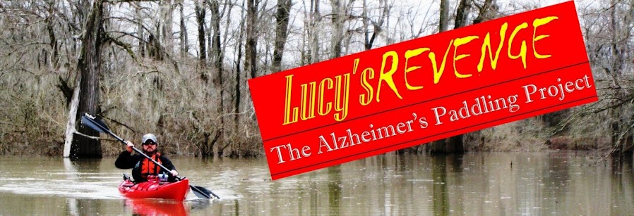
BY: B. Keith Plunkett--Lucy's Revenge

As coastal areas go, Mississippi’s coast is still a little known gem. Some see it as a diamond in the rough with opportunity for improved infrastructure for economic development. Others see an already polished jewel with environmental resources, recreational opportunities, and a rugged beauty and serenity. Much sound opinion believes man-made infrastructure is needed for the Mississippi coasts future economic development. For some of the business-first-and-last believers, the conviction overrides most every other concern.

Let me state clearly that I save my hugs for friends and family, not trees. I love the simple joys of nature, but I’m no Unabomber or neo-luddite. The point I attempt to make is that the only infrastructure needed to attract visitors to the Mississippi coast is already in place. In fact, it’s been in place for millions of years, and we should never lose sight of that.

When I decided to spend the next year of my life paddling some of the thousands of miles of Mississippi’s waterways, it was only natural for my mind to think of the Mississippi Gulf Coast. After all, there is plenty of water there. It may come as a surprise to people from outside our state that there is more to Mississippi’s coast than sandy white beaches and monstrous casinos. The diverse ecosystem of the barrier islands, back bays, rivers and marshes support an incredible array of wildlife and touring opportunity. For paddlers this is a seemingly endless menu.

In many ways, Mississippi’s gulf coast is a microcosm of the same opposing forces and troubling conundrums that exist for beautiful coastal areas everywhere. Due to the beauty of the environment, people want to be there. Good, right? But, more people lead to the need for additional man-made infrastructure that pressures, and sometimes destroys, the very reason for the initial attraction.

In the end, a fully understood compromise of these two opposing forces is as impossible to reach as the eternal dispute between night and day. But, everyone knows that both the sun and moon are required to make the tides move, and the world go round. There is a happy medium. As author and artist Alexandra Penney says, “The ultimate test of a relationship is to disagree but hold hands.”


Old Fort Bayou Blueway

Without attracting people to appreciate such beauty, conservation efforts are seriously diminished. So, it becomes necessary for environmentalists to look at ways to recruit visitors to aid in preservation efforts. Old Fort Bayou in Ocean Springs, Mississippi is just such an example. There, the Land Trust for the Mississippi Coastal Plain (LTMCP) has created the Old Fort Bayou Blueway. This trail for paddlers is a way to give conservation minded people a water level view of how conservation can integrate with outdoor recreation. LTMCP is working on this concept in other areas of coastal Mississippi, and I’ll highlight those efforts in the future.

Recently, thirty paddlers joined me on Old Fort Bayou. I happily led this excursion of first time paddlers and long time paddlers alike; from young to old. We witnessed the benefit of this beautiful resource from a personal and social perspective from our boats. The benefit of the personal experience came from the exercise, physically and mentally. Nothing pushes someone’s body to the limit quite like July heat in Mississippi. But at the end, the look of exhaustion on my fellow paddler’s faces was tempered by the great sense of accomplishment.

We all paddled to bring awareness to, and raise money for, Alzheimer’s research and support services. Many of the first-timers smiled at the idea of having completed the 10-mile trek, but to raise money and awareness for a good reason was cause for a smile on every face.

Our journey began at eight-o’clock on Saturday morning, July 10. We launched our boats heading east from mile marker number one. By mile marker two, the nervousness of some of our first time paddlers gave way to one of excitement as we spotted a pod of dolphins heading in the opposite direction towards the Bay of Biloxi. By miles four and five, the expressions were more along the lines of, “What have I gotten myself into?”

There were beautiful examples of coastal marsh flowers with butterflies all over them around markers seven and eight. At this point, the look of dread on some faces began to turn to one of determination. Upon crossing under the Interstate Ten Bridge, I settled into a turn in the bayou and one by one as tired boaters passed I informed them that our destination was right around the next bend. The reaction ranged from big smiles and sighs of relief to celebratory squeals and backslapping “attaboys”.

Paddlers landed boats and prepared to enjoy lunch. The adventure stories ensued, and all the range of emotions were in full display. It was obvious that my friends were hot, tired and hungry. But what was also obvious is that they had been nourished on the water in ways that only nature and its challenges provide.


Davis Bayou

Nothing tests new paddlers quite like open water. On day two of Lucy’s Revenge Kickoff Weekend, ten paddlers took on that challenge. This time, with the exception of me, my wife and youngest son, EVERY paddler was a newbie. Davis Bayou is protected from the Mississippi Sound by a single marsh to the south. But, choppy waters and surf from the west can cause some issues. Some of our boats didn’t quite have the length needed to deal with this very easily. But once across the bayou to the marsh a half-mile away, it became much easier for the paddlers with shorter boats to handle.

In no time at all the gulf breeze and the loosening of muscles had us all relaxed enough to carry on easy conversations. This was billed as a “fun paddle.” It could have just as easily been called the laid back paddle.

We traveled east alongside the grassy marsh until the bayou began closing in to a width of about a quarter mile before we crossed back to the north shore. Here, an uninhabited point loaded with ancient windswept live oaks, and endlessly circling gulls lulled me into forgetting how close civilization really is. Homes are a mere two-tenths of mile to the west. But, without being in view, it may as well be hundreds of miles. Paddling along the north shore, and further to the east the bayou narrows to fifty feet across. Here homes of all shapes and sizes show the challenge of coastal living. Decades of construction and destruction resulted in homes from different eras and styles standing in close proximity, from geo-domes to Spanish style haciendas to beach cottages.

We turned back and paddled the north shore to the mouth of the waterway entering Gulf Islands National Seashore. This is where we spotted the only dolphin pod for the day, but the second of the weekend. I allowed the paddlers to cross to East Beach and continue ahead, while I shot a short video. This trip was one that invited introspection and caused me to think this would be the best time to offer a recap of the weekend’s events.

After shooting a short video, I paddled hard and rode the wakes of a few fishing vessels to catch up with the other paddlers just before landing. We had put in another eight miles toward the cause.

Unlike the Old Fort Bayou trip this one offered the other side of the paddler’s coin: peace and tranquility. Such is paddling, and it sure as heck beats lying on the couch watching television.


Until next time…………………………..

Monday, July 12, 2010

Thanks to everyone for making Kickoff Weekend a huge success!

Lucy's Revenge Kickoff Weekend was July 10-11, and was a huge success. Fifty people were on hand for the Launch on Old Fort Bayou. Thirty Paddlers took on 10 miles Saturday to help bring attention to Alzheimer's Disease and to raise money for research and support services. Another 10 paddled 8 miles on Davis Bayou on Sunday.

Special thanks to Camellia Home Health and Hospice for being a Gold Level Sponsor, and to the Land Trust for the Mississippi Coastal Plain for their conservation work and providing such an excellent resource for paddlers on Old Fort Bayou. Also, a big thank you to Gulf Hills Resort and Hotel for providing such incredible hospitality, and The Shed BBQ Joint for helping us end the paddle with some excellent grub. Finally, thanks go to South Coast Paddling Company. Melissa Johnson was available to take my call anytime over the weekend, and Paul Nettles did an excellent job giving our first time paddlers a quick lesson and shuttled us anywhere we needed to be.

Only one yakker flipped their boat (my nephew, who was likely clowning around and did it on purpose). We saw dolphin on both days, and found there is much to explore on the coast, and much fun can be had despite the oil spill. We didn't see a drop of oil!

To my friends at the Alzheimer's Association, thank you for the support, we're off to an excellent start! Next up: 35 miles on the Wolf River July 16-18. Details will be available soon.

Miles traveled this weekend: 18
Miles traveled in July: 18
Miles Traveled this Region: 18
Total Miles Traveled: 18

Sunday, February 14, 2010

Trip Log-Orange Beach: I was never a Boy Scout, but now I get it.

Looking out at Ono Island from the balcony of the condo where I am residing on Perdido Key it is easy to assume the island has been tamed. The 8-mile long barrier has one house after another competing for a gawker’s attention like rows of contestants standing on a pageant stage. Ono has its own municipal government, its own infrastructure, water, and a Fire Department. It also has several interior canals for water traffic, further allowing for the use of every square inch of space to be used by boat owning homeowners. But the order ends at the water’s edge, especially on a slightly windy day, and especially on the northeastern end of the island.
Ono Island is bordered by Bayou St. John to the north and Old River to the south. The Perdido River pushes into Bayou St. John from further north via Perdido Bay. The river has only two small areas to escape to the Gulf of Mexico, Perdido Pass to the west or Dolphin Pass to the east. At Dolphin Pass the waters of Perdido must squeeze through to Big Lagoon that lies south of Pensacola at the Naval Air Station. Shifting tides and big boats that use the water ways means that someone in a kayak with a nonworking rudder has to pay attention.
Old River is somewhat protected from these confluence of currents by the island itself, which may be why the island was originally named Orinoco by the Spanish in the 15th century, meaning “a place to paddle.” As I write this morning from the balcony with coffee in hand overlooking Old River at least 6 paddlers have already passed; five in one group were being directed by a coach from a small motor boat, and one gentleman paddled by several minutes later in a beautiful shiny wooden kayak. 


A paddler enjoys the calm waters and confines of Old River on a Sunday morning excursion. 


The dolphins like Old River, too. Thanks to the generosity of friends, my family stays at this same spot every trip to Coastal Alabama and the dolphins never fail to show up to entertain the kids while feeding in the shallow waters. From this vantage point Old River is tranquil and welcoming. So, it is with a lackadaisical attitude that my wife and I hopped in our Wilderness Tsunami Kayaks around 1:00 pm for a short two hour trip. We made no particular plans except to take a quick look at a map online. We’d be back in plenty of time to shower, and prep the redfish we purchased for grilling that evening.


That was our first mistake.


Big open water is a lot like big open spaces on land. Distance is tough to estimate. I can recall as a young man walking the row crops of my father’s farm and thinking how close the trees looked on the far end of the field. You could sometimes walk blisters on your feet and still be barely half-way across.
We paddled west out of Old River around the end of Ono and north towards a peninsula that juts out to help form Terry Cove to west. After stopping to enjoy a flock of around 50 pelicans on one of the uninhabited islands that dots the water north of Perdido Pass, we hugged the north shore of Terry Cove, paddling past the Orange Beach Marina.


A few of the 50 or more pelicans can no longer resist the urge to take flight when my kayak closes in.

Nice little tour. And it should have ended there. At that point we could have easily back paddled, or maybe went south to Cottons Bayou and around a couple of other small islands. Then we could have headed home to a cold beer and the smell of a preheating grill.

But, we didn’t do that.


My wife and I have always enjoyed hopping in the car with no specific plan to drive and sightsee. But, that attitude can get you in trouble on the water with the sun dropping, and the temperature with it. We were thinking—that is thinking and not knowing— that we could easily make it all the way around the north side of Ono. The thought was that we would circle the eastern tip and head west on Old River, but we were paddling into waters we did not know.


That was the second mistake.


A few hours earlier, prior to launching our boats we took a short look at an online map and paid no attention to mileage. It simply looked doable. But, looks can be deceiving. If real life were as easy as a map I wouldn’t spend time sitting in traffic most mornings. It’s all about the unforeseen.
After paddling the north shore of Bayou St. John, we crossed from the peninsula that bordered Perdido Bay south to the Peninsula that protects Goat Bayou on Ono Island. Here is where the water began to get choppy, where the cold brackish water and the big power boats had little concern for a boat without a controllable rudder.   But I didn’t stop to notice the signs. We soldiered on.


A closer look at the map (post trip) shows that the north side of Ono squeezes the waters of Perdido River via Perdido Bay into less than a quarter mile. Then it further narrows at Dolphin Pass. We were caught in some heavy churn here that caused us to seek refuge and possibly another passage to Old River through a series of man-made canals for the islands homeowners. But, with no outlet found and at least another hour lost, we had to leave those safe confines and again hit the churn of Perdido. I made a not-very-popular-decision with my travelling companion; we would continue east around the tip of Ono and then get to Old River as quickly as possible.  I figured with the wind and current behind us we would make good time, much better than if we attempted to back paddle facing the wind and the current, and my wife was complaining that she was wearing down.

Sharon is pleasantly distracted with a playful dolphin off the northeastern shoreline of Ono Island. Notice the increasingly choppy waters.


Her dissatisfaction with the decision was momentarily forgotten when a dolphin came within a few feet to get a closer look, and I pushed ahead to negate any attempts at lobbying on her part. By the time I slowed and she caught up, we were too far along to go back. As we reached the eastern tip of Ono, she began to relax, but with the sun setting the temperature was dropping fast. I had to make another quick decision. We weren’t going to make it the full 7 mile length of Old River back to the condo. So, I headed south toward Perdido Key State Park, and as close to Highway 292 as quickly as possible. Again, she began lobbying, but again as my fingers went numb from the plunging temperatures, I pushed ahead.
I quickly unpacked my phone from the dry pack upon hitting the sands of the Park, called my oldest son Isaac to instruct him to drive east, helped my now arriving wife from her boat, and trudged the quarter mile of dunes, sea oats and briars having learned a valuable lesson.
From now on, no matter how easy it looks, I’ll print and take a map with me to be sure I have easy access to the lay of the land. Things look different on the water. I’ll stop and consider the signs around me. I’ll take the time to fix a problem with my gear, like a loose rudder, before I launch. And, I’ll always know that a quick and easy 5-mile trip can unexpectedly turn into a difficult 15-miler with one bad decision.